Written by: Fateme Haftakhtan
What a harvesting site taught me about maps, technology and real forests
Before taking the Wood Procurement module, I thought I had a pretty good idea of how technology is used in forestry today. We have GIS, remote sensing, forest inventories, digital maps and many different software tools. With all this information, we can learn a lot about a forest without even going there. We can see forest stands, roads, tree information, and many other things just by looking at a screen.
So, I sometimes wondered: if we already have all this information, how important is it to actually go into the forest? After this module, I have a much clearer answer: very important.
This does not mean that I think technology is not useful. Actually, I have started to understand much better how useful it is, especially in wood procurement. But I also realised that a forest is not quite as simple as it looks on a map. There are always things that we cannot fully see from a computer screen.
When the map meets the real forest
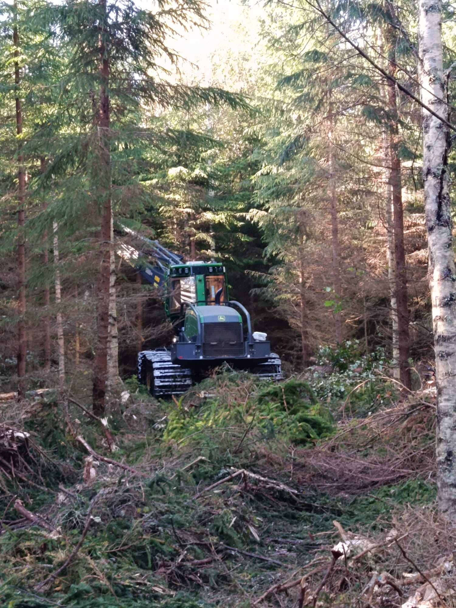
One of the most interesting parts of the module for me was visiting a harvesting site and talking with a harvester operator. Before that visit, I had mostly thought about forest information from the planning side. I knew that maps and GIS were used for planning harvesting, but I had not really thought about what happens when all that information meets the actual forest.
The operator told us about situations where the information on the map did not show everything that was actually there. For example, a small water body, or a bird nest might not have been marked. Sometimes, he noticed these things only after entering the forest with the harvester.
I found this quite interesting. On a computer screen, a harvesting plan can look very clear. We can see the stand, the boundaries, and other information, and everything can seem ready to go. But when you actually get into the forest, things can look a little different.
For the operator, this can also be a problem. The machine is already there, the work has been planned, and then suddenly there is something unexpected. He has to stop and figure out what to do. This made me think that a map can tell us a lot about a forest, but it cannot always tell us everything.
But the operator also pointed out the other side of the story. Maps can be really helpful in his work, especially in winter. When there is a lot of snow, some things on the forest floor can be difficult to see. In that situation, forest information can help the operator understand where certain areas or important features are located. So, I did not come away from the visit thinking that technology is bad or that people are always better than computers.
For me, the main point was much simpler: we need both. The map helps us before we enter the forest, and the forest helps us understand what the map might have missed.
From a map to wood procurement
This experience also changed the way I think about wood procurement. Before this module, I probably saw wood procurement mostly as getting timber from the forest to the customer. Now I see that there is much more going on behind it. It starts with forest information and planning, and then continues with harvesting, transportation, and finally getting the right wood to the right place.
GIS and remote sensing can help a lot with this. They can help us understand forest stands, plan harvesting and make the whole process more efficient. But there is one important thing: we still need people who understand what all that information actually means.
For example, a map might show that a stand looks suitable for harvesting. But when a forestry professional visits the site, they might notice something that was not obvious on the map. Maybe there is a small habitat, a water feature, a nest or simply something about the terrain that was not clear from the available information. And then the plan may need to change.
This is one thing I really started to understand during the module. A forestry professional is not just looking at trees. They have to think about biodiversity, environmental values, regulations, certification, timber quality, productivity and what is actually possible at the site.
Sometimes, these things do not all point in the same direction. That is why I do not really see the future of forestry as humans against technology. I think it is more about humans working with technology.
What about AI?
This also made me think about AI. Technology is developing very fast, and AI is already being used in many different areas. In forestry, it could help us analyse large amounts of forest data, identify damage, predict growth and support harvesting or wood procurement planning.
It is easy to imagine that in the future we will have much more advanced systems than we have today. But I still think someone will need to look at the information and make the final decision. A computer can give us a prediction, but a person needs to ask: Does this actually make sense in this forest?
That human experience is something I do not think we can easily replace. And maybe this becomes even more important because forests themselves are changing.
The forest is changing too
Climate change is not something separate from wood procurement. It can affect forests in many ways. Drought, storms, pests and diseases can affect tree growth and forest health, and this can also affect the amount and quality of timber available in the future.
This makes wood procurement a little more difficult to predict. A plan that works well today might need to be changed in the future because the forest has changed. We may need to be more flexible and ready to react when things do not go exactly as planned.
This is another reason why I think both technology and field experience are important. Technology can help us see changes over large areas and give us useful information. But people still need to go to the forest and understand what is actually happening there.
What I take from the module
Looking back at the module, I think the biggest thing I learned was not one particular software or one specific part of wood procurement. It was learning to connect the information on the screen with what is actually happening in the forest.
Before, when I looked at a forest map, I mostly thought about what the map was showing me. Now I also think about what might be missing.
And when I think about a harvester working in the forest, I can see the connection between that machine and all the information that comes before it. GIS, forest inventories and planning are not just things we do on a computer. They can directly affect what happens on the ground.
At the same time, what happens on the ground can also show us where our information was not perfect. I think this will become even more important in the future. We will probably have better maps, better sensors, and better AI. These tools can help us work more efficiently and deal with a changing climate.
But no matter how good our technology becomes, the forest will still be the forest. Someone will still need to walk through it, look around and sometimes say: “This was not on the map.” And maybe that is the main lesson I take from this module.
The map is important, but it is only part of the picture. When the map meets the forest, we get a much better understanding of what is really happening.
References
Metsähallitus. (n.d.). Use of geographic information in Metsähallitus. https://www.metsa.fi/en/lands-and-waters/geographic-information/
Metsähallitus. (n.d.). Biodiversity in multiple use forests. https://www.metsa.fi/en/responsible-business/metsahallitus-forestry/biodiversity-in-multiple-use-forests/
Natural Resources Institute Finland (Luke). (2026, April 23). Commercial fellings 2025. https://www.luke.fi/en/statistics/commercial-fellings/commercial-fellings-2025